10 May
7:30 pm - 9:00 pm
Use the ParkHouston app for easy parking.
Join the Mailing List Support Your Park
Make a donation


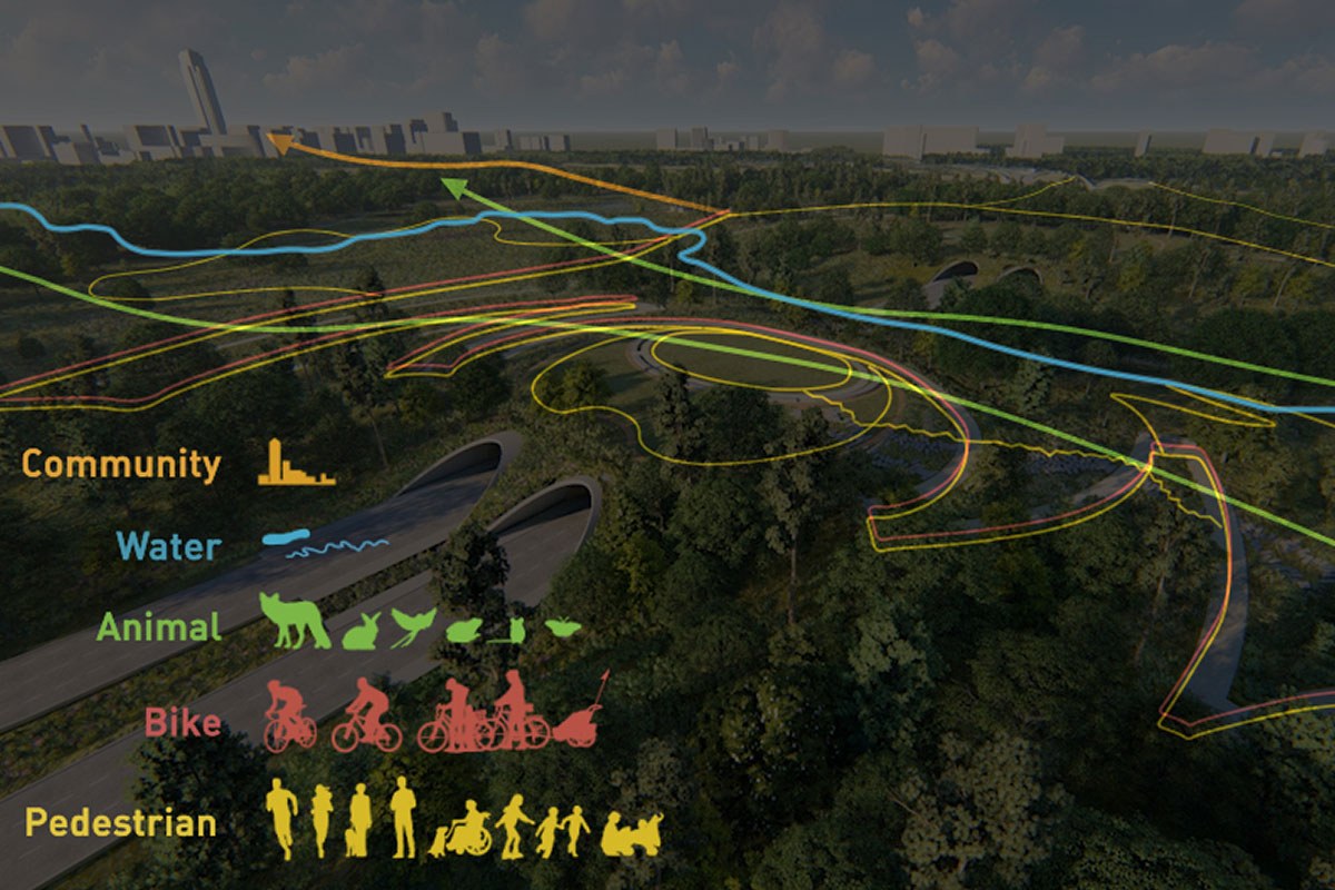
The Land Bridge and Prairie project, coming to Memorial Park in early 2023, is the next major project of the Memorial Park Master Plan to be delivered, and is among the set of accelerated projects made possible by the Ten-Year Plan. This transformative, nearly 100-acre project will reunite the north and south sides of the Park by creating a land bridge over Memorial Drive to establish a dynamic new community space and enhance recreation opportunities for Park users.
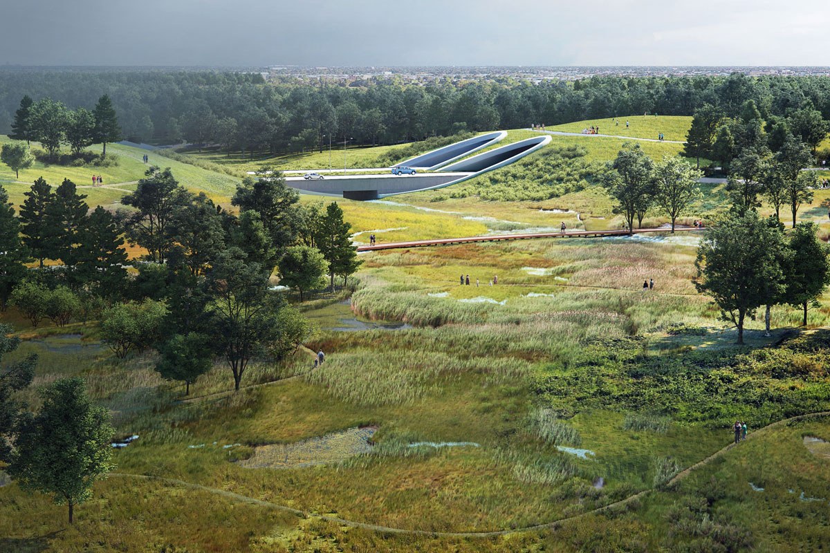
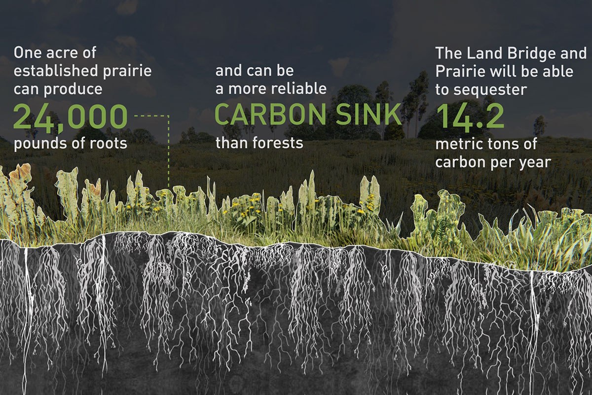
The prairie restoration, which adjoins the Land Bridge, re-introduces endangered native Gulf Coast prairie and additional wetlands to areas north and south of Memorial Drive. A new network of trails will provide safe crossing for people and wildlife. Both prairie and wetlands serve important habitat and stormwater management functions and are a key part of the Park’s ecological restoration to ensure resiliency.
Together, the Land Bridge and Prairie will distinguish Memorial Park and Houston, serving as an icon to all of a greener and more resilient future. Information about the official opening celebration can be found here. Memorial Drive will remain open throughout the duration of the project.
To learn more, scroll down view a video and answers to FAQs about the Land Bridge and Prairie.
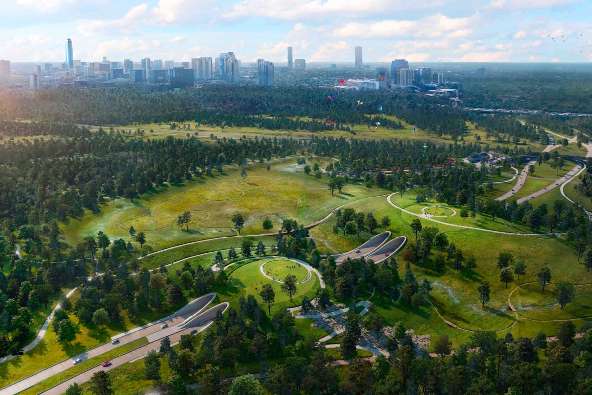
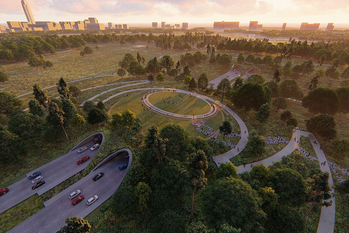
Highlights and benefits of the Land Bridge and Prairie project include:
Construction began in August 2020 and is slated for completion late 2022.
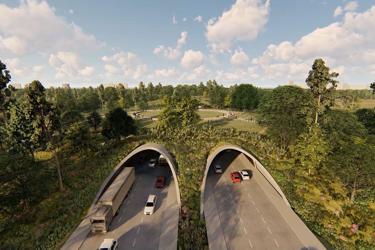
Memorial Drive will remain open during construction. Within the project area, traffic will be reduced from three lanes to two each way while a new section of Memorial Drive and the tunnel arch structures for the Land Bridge are completed directly south of the operating lanes. All lanes will reopen once construction is complete. A traffic study was commissioned to assess peak-hour commute times through the Park, and the construction plan is designed to minimize disruption.
")
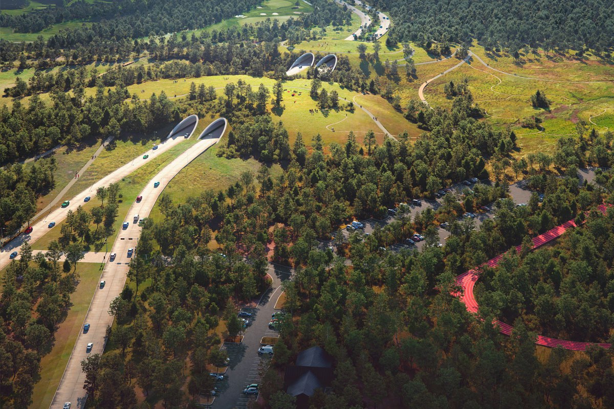
A new multi-use trail for people of all abilities will be incorporated along the south side of the Prairie and will connect to the adjacent existing south-side natural trail system. Ultimately, it will also connect to a future north/south hike-and-bike trail that will be developed along the CenterPoint easement adjacent to the railway line that will connect Memorial Park to Houston’s growing network of hike-and-bike trails. Bayou Wilds trails reconstruction is shown below. Click HERE to view our Memorial Park Trails Guide.

No, Memorial Drive will remain at the same level. The arch structures for the Land Bridge will be built over the new section of Memorial Drive.
The Commuter Trail is the paved hike-and-bike trail that runs the length of Memorial Drive along the south side of the Park. The project will provide a dedicated multi-use trail along the south side of the Land Bridge between Picnic Loop and the Cullen Running Trails Center where it will then reconnect with the existing Commuter Trail. A temporary multi-use trail will be in place during construction to provide an uninterrupted path around the construction areas.
A new segment of the Seymour Lieberman Trail, including new pedestrian lighting, will skirt the north edge of the Land Bridge and will be constructed prior to any construction impacts to the existing trail. The trail will be moved away from the traffic flow on Memorial Drive and create additional separation between trail users and automobile traffic to improve safety and provide a better Park user experience.
Ball fields will be relocated to the new Sports Complex on the north side of the park. In addition, the existing landscape, roadway, and parking lots will be relocated and the site will be excavated, providing soil for the top of the Land Bridge and creating a unique site to be replaced with native coastal prairie to restore habitat, create greater resiliency and enhance the Park’s ability to hold stormwater onsite.
The Land Bridge and Prairie project is an ecological conversion process, and trees removed during this process will either be relocated or repurposed within the Park to support a network of native Gulf Coastal Prairie and Savanna ecologies, as envisioned by the Memorial Park Master Plan. These ecologies once extended over 9 million acres from Corpus Christi, Texas to Lafayette, Louisiana. Today, less than 1% of native Gulf Coastal Prairie habitat remains. Native prairie and savanna ecology is more resilient than the forested habitat that exists in this area today and will promote regional biodiversity of both plant and wildlife species while also helping to absorb and clean stormwater.
Moving trees allows us to conserve a beloved resource and provides an opportunity to relocate high-value native tree species to other Park areas. Some trees will be relocated to areas in the Park designated for reforestation. Other trees will be relocated to increase shade along pedestrian pathways like the Seymour Lieberman Trail.
The Land Bridge and Prairie is a $70 million project. Most of the funding is from private philanthropy.

No. The Memorial Drive Tunnels are for street traffic only. There will be a multi-modal commuter trail implemented to the south of the Tunnels for all other traffic and pedestrians.
The Tunnels will be well lit. They are lit by both natural light during the day, as well as an overhead lighting strip that runs the length of each tunnel. These lights remain on 24 hours a day and respond to natural light conditions to maintain an optimal field of vision.
No. No stopping or parking is allowed in the Tunnels as they are for continuous traffic flow only. Designated pull-over locations are at the Picnic Lane intersection to the west and the Picnic Loop entrance to the east, at either end of the tunnels.
No. While Memorial Drive is two-way, each tunnel is one-way traffic only, either westbound or eastbound.
Each tunnel is 25-feet tall by 54-feet wide.
The break in the Tunnels allows for light filtration to the culvert beneath the road, which assists wildlife crossing. This break also allows for more air flow through the Tunnels, which is also aided by the Tunnels’ height.